About the section
The section on Ingmarsö is the key to much more.
Here you have the opportunity to experience open landscapes thanks to grazing animals. You can be touched by winding paths over undulating terrain through beautiful forests, hike past lakes and find your own spots to swim.
The 9,1 km section of Stockholm Archipelago Trail is just a taste of what you can experience around you. Ingmarsö, Brottö, and Finnhamn are interconnected and can be explored both via the trail and through the local map available in the grocery store, among other places. In that map, you will find other suggestions for local trails to hike.
Ingmarsö is easily accessible thanks to the gravel roads on the island. Ingmarsö has some hidden gems that you absolutely must not miss: Ingmarsö Bageri (bakery), Ingmarsö B&B and Ingmarsö Krog.


How to hike the trail?
You have the opportunity to start your hike from the two quays where the ferry arrives: Ingmarsö Norra or Ingmarsö Södra. By the northern quay, you will find a nice place for a swim just a little further in. From there it is also close to Ingmarsö B&B. At the southern quay, there is a grocery store that is open year-round and Ingmarsö Krog, a local restaurant.
Regardless of where you choose to start your hike, we have marked the trail in a counterclockwise direction, which we recommend.
If you disembark at the southern quay, you will soon pass by the guest harbor, from which the trail goes straight north along the gravel road. You cannot walk along the water as you will enter a dangerous area, the boat yard.
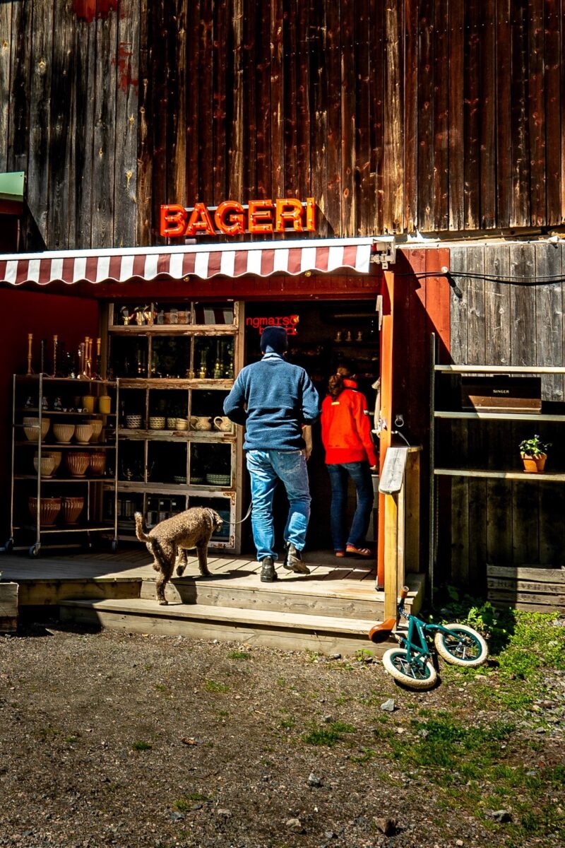
What you must not miss is Ingmarsö Bageri; it is a small detour of a few hundred meters, but it is so worth it. The bakery has a very nice atmosphere, wonderful service, great food and of course, delicious pastries. Here you can both eat and do Swedish fika.
When you reach the eastern end of the trail, you will find a small beach to the right, Femsundbadet. Be sure to take a dip before continuing into the forest on the beautiful path. From Femsundbadet, you can also continue eastward on the “Båtluffarleden”.
On Ingmarsö, you can stay several days and explore the trail and other points you can find on the local map.
The stages of Ingmarsö, Finnhamn, Brottö, and Svartsö are very well connected. You can also add Möja or even Lidö if you use the north-south ferry line (Nordsyd linjen) in the summer.
Trail markings
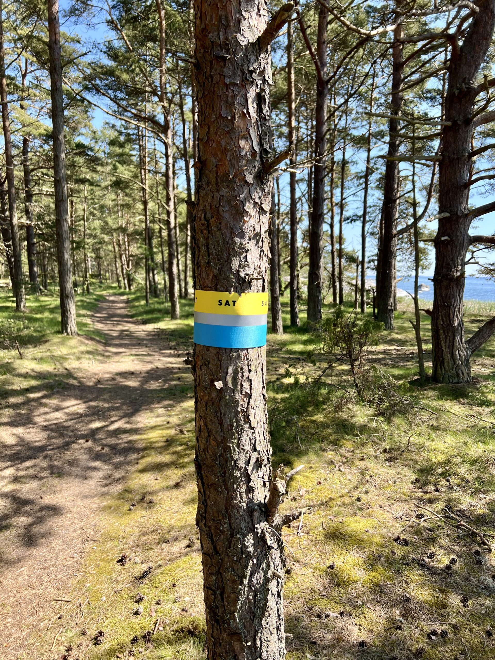
Follow the trail marked with ribbons and arrows where blue represents the sea, the yellow represents the sun, and a reflecting center line represents the shimmering horizon. This also makes the trail visible in the light of a headlamp.
The marking of the trail is done in one direction, either clockwise or anti-clockwise according to “How to hike the section?”. Where it is obvious where you should walk the marking is sporadic, where it is unclear or at intersections the marking is much closer together. If you do not see a marking continue straight on the path you are on or check out your position in the digital map.

Accessibility on the trail
On Ingmarsö, you can experience most of the trail if you have a stroller, or if you are in a wheelchair or if you have limited mobility. From both ferry quays, you can navigate the gravel roads and enjoy the beautiful surroundings. You can reach Ingmarsö Bageri, Ingmarsö Krog, and Ingmarsö B&B.
You should avoid the the sections north or east of Femsundsbadet.
Frequent questions about Ingmarsö
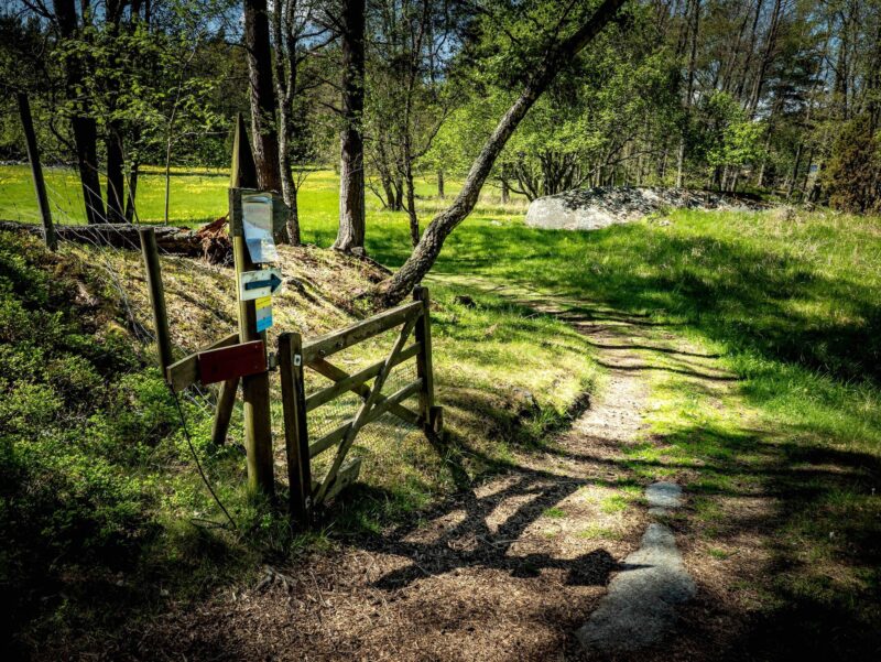
In the pastures on Ingmarsö, there are grazing animals. If the gate is closed, you can still pass along the trail, but you must ensure to close the gate and keep your dog on a leash.
You can experience this at the eastern end of the trail, where it connects to the “Båtluffarleden”, and if you choose to continue on it.
Ingmarsö and Finnhamn are connected by a hiking trail marked in blue called Båtluffarleden (the Boat Hiker’s Trail). It takes you via Kålgårdsön to a small passage of open water where there are two rowboats placed for you to cross over to Finnhamn.
You are responsible for ensuring that there is always one rowboat on each side. This means you will need to row back and forth an extra time with a rowboat in tow. Read more here
The right of public access means that you have the right to pass through someones land. It is also an obligation which means that you must respect the landowner by passing as discreetly as possible.
About Ingmarsö
Ingmarsö is an island in Stockholm’s central archipelago, located in Österåker Municipality. It is a relatively large island with about 150 year-round residents. During the summer, many summer guests come who own summer houses or visit the island.
Ingmarsö has been connected to Brottö due to land uplift thousands of years ago. The island was first mentioned in writing in the late 15th century. By the mid-1500s, there were four farms on the island, and about 25 people lived there.
In 1719, when Brottö suffered greatly from the Russian raids, Ingmarsö managed to survive. During the 19th century, people lived off fishing and farming, and more residents moved out as Stockholm grew. This was to contribute to the need for fish, firewood, and other necessities. These goods were rowed or sailed in.
At the beginning of the 20th century, summer guests began to discover Ingmarsö and established themselves there.
Today, there is a year-round store, a restaurant, a bakery, a B&B, a preschool, a library, a boatyard, a guest harbor and other businesses that keep Ingmarsö vibrant throughout the year.
Plan your trip
You can travel to Ingmarsö from Stockholm city, from Vaxholm, from Åsättra (Ljusterö), and Boda (Värmdö) year-round. The islands of Svartsö and Finnhamn are on the same ferry line.
Search for Ingmarsö Norra or Ingmarsö Södra in the Google travel planner below.
Eat, sleep and do on Ingmarsö
On Ingmarsö, you can enjoy good food at Ingmarsö Krog and Ingmarsö Bageri, where you can also have Swedish fika and buy delicious bread. The best place to stay is at Ingmarsö B&B.
In the grocery store at Ingmarsö Södra, you will find a good selection of food year-round and you can also rent a bicycle there.
On Ingmarsö, you will always feel welcome. See Explore Archipelago for other ideas.
The right of public access – an obligation when venturing into nature
In Sweden we have a common law called “The Right of public access”. It is fantastic to have the freedom to roam but it comes with obligations. The existence of the Stockholm Archipelago Trail is solely thanks to the goodwill of all landowners. In nature, we respect all people, all animals, and all protected areas. We leave only footprints behind and we take only memories with us.
Please take whatever garbage you generate back to the mainland where waste management works and is available. On the islands it is expensive and complicated. Please use public toilets or make sure that there is no trace left behind.
From March to September, dogs must always be kept on a leash.
Respect fire bans and absolutely do not light fires on the rocks. They crack.
Read more here
